Auchenlone Indicator
The Auchenlone Indicator (2068 feet above sea level)
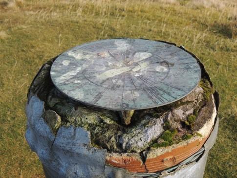
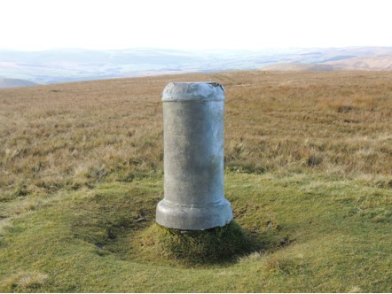
The indicator marks the summit of AUCHENLONE
(East Mount Lowther on the Ordnance Survey Map)
It shows, in good conditions, the height in feet and approx distance away
in miles of visible hills.
For Example:
Ben More 3843ft at 77miles away
Ben Lomond 3192ft at 66 miles away
Paps of Jura 2571ft at 96 miles away
Goatfell 2866ft at 58 miles away
Tinto 2335ft at 16 miles away
Capel fell 2273ft at 18 miles away
Ettrick Pen 2270ft at 20 miles away
Sca Fell 3210ft at 67 miles away
Criffell 1866ft at 30 miles away
Black Craig 2298ft at 14 miles away
The Indicator was the work of the Wanlockhead Youth Club under the supervision of T.E.M.Landsborough and W. Stevenson.
A certain time of making do was necessary in the early 1940s, and the construction of the pillar is of interest.
It is made from a section of large bore water pipe filled with concrete.
There is a bronze plaque placed on top with the indicator markers etched in.
The indicator was dedicated on the 21st may 1944.

